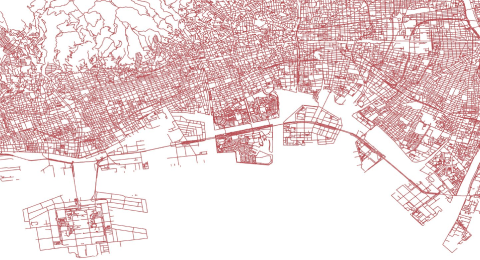
road center line
- API
Features
The road centerline vector tiles
This data is downloaded from the road centerline vector tiles that GSI is experimenting with providing, and merged in secondary mesh units.
Source: GSI website
Currently, the mesh code ranges that can be specified and viewed are as follows
Near Ibaraki and Tochigi : Standard secondary mesh codes starting with the values 5339, 5340, 5439, 5440, 5539, 5540.

Getting started
By starting to use the tool, you are considered to have agreed to the terms of use.
Step 1: Issue an API token
Create the authentication token required to execute the API. When executing the API, use it as {"Authorization": "Bearer {{issued API token}}"}.
API TokenStep 2: Execute by referring to the API reference
For specific endpoints by function, please refer to the API reference.
API Reference| Provider | Association for Promotion of infranstructure Geospatial Information Distribution |
|---|---|
| Terms of use | 道路中心線データ利用規約(PDF) |
| Notes | - CC BY SA - In accordance with the GSI Content Usage Agreement, please indicate that the source is the GSI Vector Tile Provision Experiment. https://www.gsi.go.jp/kikakuchousei/kikakuchousei40182.html - This data was extracted from the data provided in the GSI Vector Tile Provisioning Experiment, and the road centerline data was extracted and merged in secondary mesh units. The year of data acquisition is as of December 2019 and is not the latest data. Source: GSI website |
| Environment in which tool can be used | Available outside of Tellus |
| User manual, API reference | - API reference |
| Changelog | v0.2 October 24, 2024 - Changed response format - Updated Servers' addresses |