“Tellus Satellite Data Master with QGIS” Update: “Tellus-LFP (Tellus-Learning From the Past)” added and improved usability of satellite data search function
NewsDear Valued Customer,
On July 11, 2024, we updated "Tellus Satellite Data Master with QGIS", a cloud environment with pre-installed QGIS that allows the use of satellite data provided by Tellus. This update includes the addition of the tool "Tellus-LFP", which enables animation of GCOM-C data over time and graphing of time-series data for specified locations on QGIS. Additionally, we have improved the usability of the satellite data search function.
< Tellus-LFP (Tellus-Learning From the Past) >
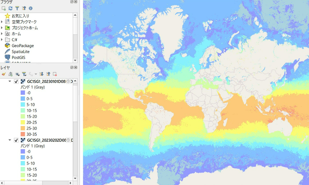
- Automatically color GCOM-C SST and CHLA data
GCOM-C data is displayed in grayscale by default on QGIS, making it hard to interpret.
Assigning appropriate colors to each value makes it easier to understand data, but this can be time-consuming if done manually. With Tellus-LFP, you can easily batch color-code the data.
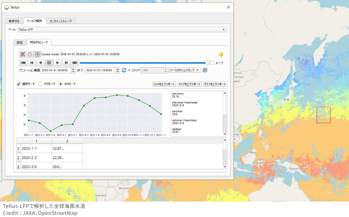
- Display GCOM-C data in time series graphs
The data observed by GCOM-C allows you to investigate how the Earth's environment changes over time. By preparing multiple sets of GCOM-C SST or CHLA data on QGIS, you can select a point on the map to display its time series data. If you select an area, the average values within that area are automatically calculated and graphed, reducing the manual effort required for data analysis.
- Animate Images Over Time
Tellus-LFP allows you to create animations from multiple scenes. This helps you visually understand the time-series changes in observations across the globe.
<Improved the usability of the satellite data search function>
To make the many satellite data provided by Tellus easier to use on QGIS, we have improved the usability of the search function.
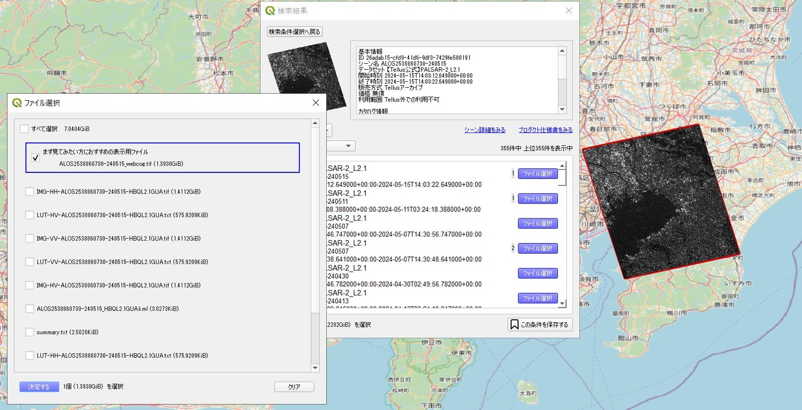
- Download multiple data at once
Previously, only one scene could be downloaded at a time.Now, you can select multiple scenes from the filtered satellite data and download them all at once.
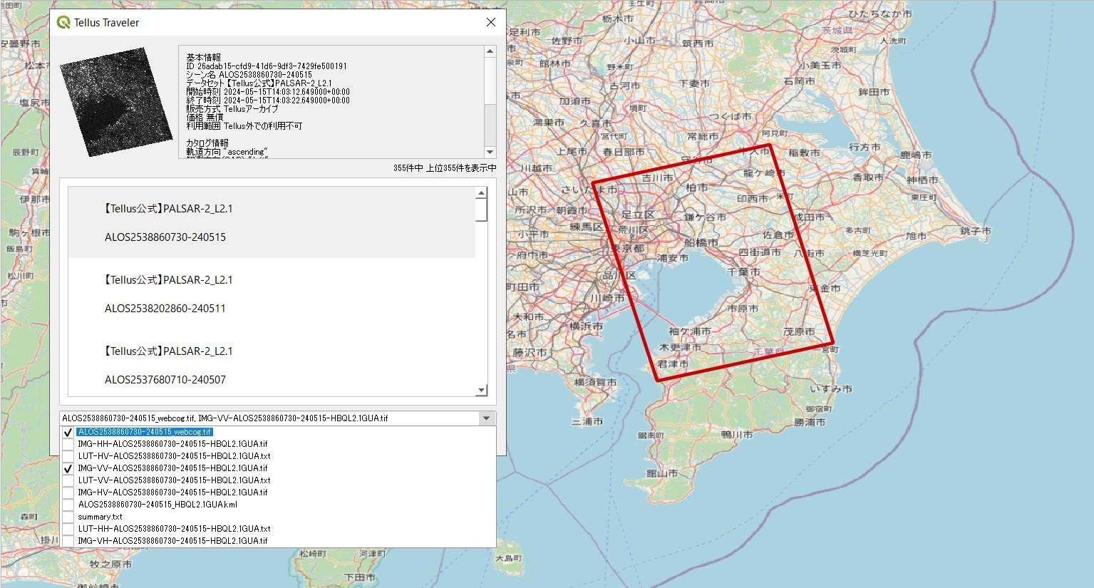
- Display Thumbnails on the Map
Previously, to view satellite data on the map, it was necessary to download the data first. Now, after filtering based on search criteria, thumbnail images will be displayed directly on the map. This allows for a quick preview before downloading.
Old Interface: Data must be selected and downloaded scene by scene, with only the frame of the selected scenes displayed on the map.
New Interface: Select data from multiple scenes and download them all at once. Additionally, thumbnails of the selected scenes are displayed on the map.
Additionally, we have added a feature to save search conditions. Please try the new "Tellus Satellite Data Master with QGIS" and experience enhanced satellite data analysis.
< Service details and application process >
Please check the URL below and apply.
https://www.tellusxdp.com/en-us/dev/
* You need to log in to Tellus to use the analysis environment service. If you do not have a Tellus account, please register.
https://www.tellusxdp.com/account/login/
< Related articles on Sorabatake >
An article on how to use "Tellus-LFP" is available on Tellus's owned media, Sorabatake.
The article is available only in the Japanese language.
https://sorabatake.jp/37339/
* QGIS is open-source software, and "QGIS" is a trademark of QGIS.ORG.
* "Tellus Satellite Data Master with QGIS" is a service developed by Tellus Inc. using QGIS.